A University of Utah team has mapped a vast, hidden ice reservoir within the Timpanogos Rock Glacier, located near Salt Lake City and Provo. Using a novel 3D technique, researchers measured the rock glacier to contain 1.5 million cubic meters of ice, a volume comparable to the largest pyramid in Giza, Egypt, according to Bronson Cvijanovich, a former graduate student in the Department of Geology & Geophysics and lead author of a study on its internal ice content.
The newly quantified ice mass is equivalent to filling 600 Olympic-sized swimming pools, a University of Utah news release states. Cvijanovich noted that the Timpanogos Rock Glacier is “surprisingly ice rich,” consisting of 83% ice and 17% loose rock. This specific rock glacier is one of 836 in Utah, with such formations being common across the Wasatch and Uinta mountain ranges. While their surface outlines can be identified through satellite imagery, the university release explained that their three-dimensional shape, depth, and the ice they conceal are far more challenging to uncover.
Leif Anderson, a glaciology professor who supervised the study, emphasized the scale of these hidden reserves. “There’s a lot of ice that’s hidden in Utah’s mountains,” Anderson said, explaining that individuals walking across seemingly loose rocks high in the mountains might not realize up to 120 feet of ice lies buried beneath them.
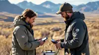
To determine the ice content, the research team made multiple treks to the rock glacier in 2024. These expeditions involved a roughly five-mile hike with an elevation gain of 3,500 feet, during which sensitive instruments, including a gravimeter, were transported. Gravity readings were collected at 232 points, spaced approximately 80 feet apart, arranged in a grid across the rock glacier's surface.
The gravimeter works by measuring density differences between rock and ice, which enabled researchers to calculate the buried ice body's three-dimensional shape, according to the university release. After initial data collection, the team undertook the complex task of correcting these measurements. Adjustments were made to account for variations in gravity caused by factors such as the positions of the sun and moon, the specific terrain of the location, latitude, and elevation.
Another study by University of Utah researchers, using a new mathematical model, shed light on how these rock glaciers acquire their ice. The research demonstrated that rock glaciers gain mass when rockfalls bury persistent snow in their upper sections, the news release detailed. Anderson further clarified this process for the local environment, stating that “In the Wasatch, the mountains themselves are eroding and burying the snow, and that’s why the rock glaciers exist.”
Despite ongoing climate change, the Timpanogos Rock Glacier appears to continue accumulating ice, the researchers noted. Cvijanovich highlighted the unique protective quality of these formations: “Rock glaciers flow downhill just like a glacier or river, but the important distinction here is that the thick carapace of loose rock actually protects and hides the ice, making these climate-resilient water storage sites that may still be adding frozen water.” He underscored the significance of these findings, particularly for resource management, adding that from a water resource standpoint, this is “really important, especially in a warm and arid state like Utah.” The findings provide a clearer understanding of a substantial, protected water source within Utah's mountains.